|
Organic Listings Powered by TheOkayNetwork
|
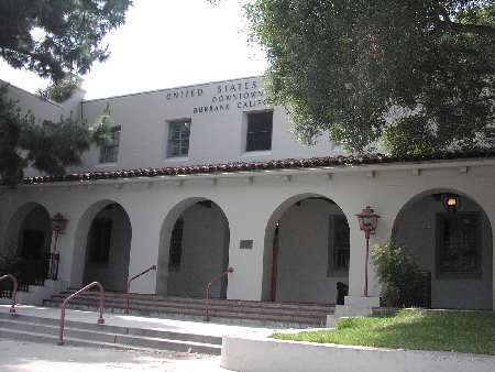
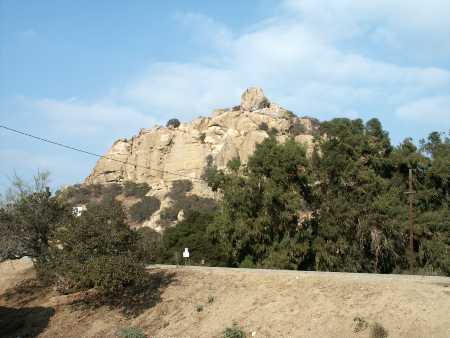
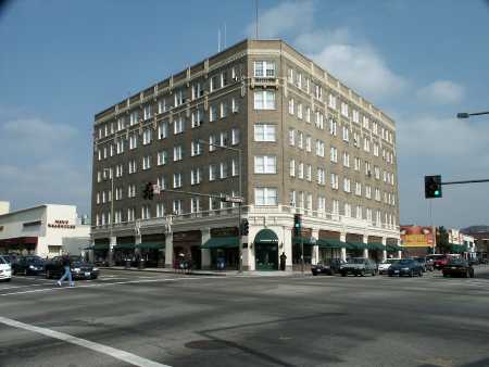
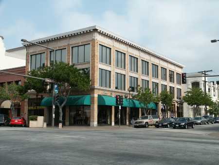
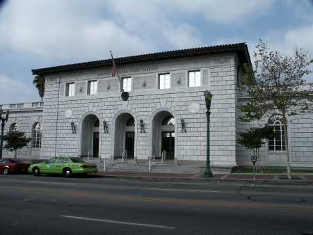
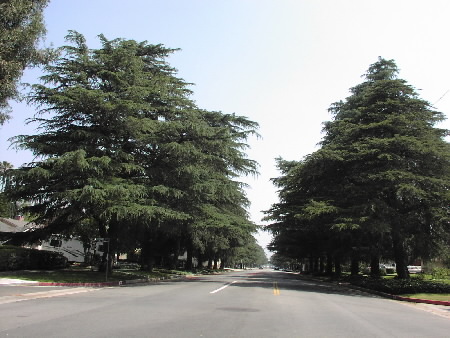
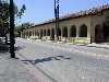
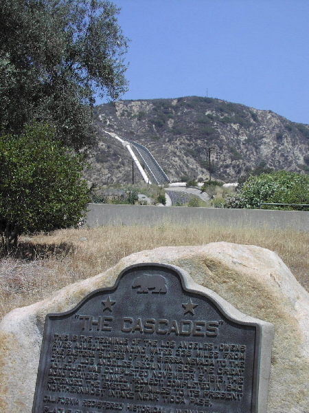
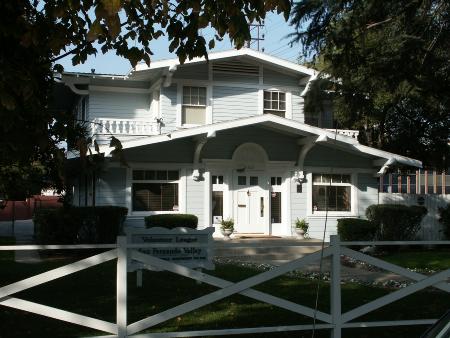
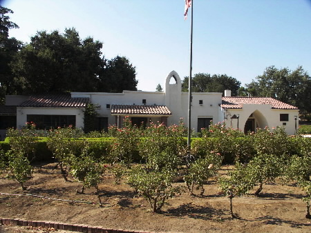
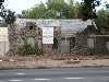
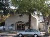
Valley Landmarks in Burbank, California
|
|
|
|
|
Top of Page
|
Valley Landmarks in Calabasas, California
|
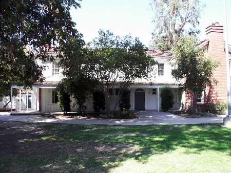
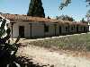
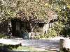
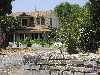
Leonis Adobe  Map URL Map URL
Built in Monterey style in the 1840's, it was occupied by Miguel Leonis as early as the 1870's, one of the most colorful, influential and prominent figures of early Los Angeles. Declared: 8/6/62 . Open to the public Wednesday through Sunday 1 to 4 p.m.
23537 Calabasas Road
Calabasas, CA 91302
818 222 6511
See user reviews
|
|
Top of Page
|
Valley Landmarks in Canoga Park, California
|
|
|
|
|
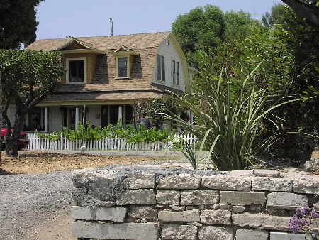
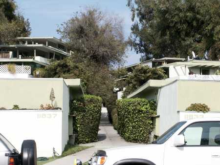
Lederer Residence and Immediate Environs Map
Constructed over a period of years by the owners starting in 1934, with the help of builder John R. Litke, materials were chosen with the greatest of care and painstakingly employed in such a manner as to make them appear old. It is a distinguished example of Mission-style architecture in which the interior and exterior detailings are of museum quality. The Spanish and Italian furnishings are of particular interest, dating from the 14th Century. Declared: 11/15/78
23134 Sherman Way
Canoga Park, CA 91307
See user reviews
|
|
Shadow Ranch Map URL
Built between 1869 & 1872 on the original Workman Ranch, this house is part adobe and part redwood. Declared: 11/2/62
22633 Vanowen Street
Canoga Park, CA 91304
818 883-3637
See user reviews
|
|
Top of Page
|
Valley Landmarks in Chatsworth, California
|
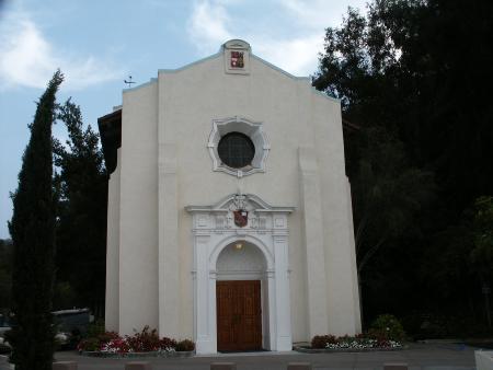
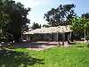
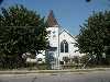
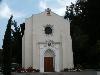
Chatsworth Community Church Map
Original location at 10051 Topanga Canyon Blvd, Oakwood Memorial Park. Built in 1903, it is the oldest public building in the community of Chatsworth. It is reported to be one of the few churches of New England-type architecture left in Southern California. Declared: 2/15/63
22601 Lassen Street
Chatsworth, CA 91311
See user reviews
|
|
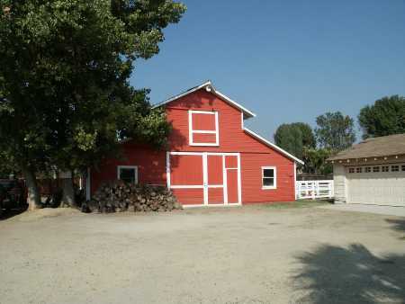
Harvester Farms (site and barn only) Map
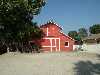
Erected in the early part of this century, the complex of buildings evokes a rural farm atmosphere in the midst of what is now a suburban setting. The main house is a California Ranch style structure. The rear California basilica-type barn still retains a high degree of remaining historic fabric. This site was the headquarters of the Palomino Horse Association of America. The barn was the birthplace of Mr. Ed. Declared: 12/19/97
22049 Devonshire Street
Chatsworth, CA 91311
See user reviews
|
|
Hill-Palmer Cottage Map URL
Chatsworth Park South. This little ranch cottage is typical of those built by the homesteaders of the San Fernando Valley with their own hands. Declared: 11/20/74. Open 1st Sunday each month 1:00 p.m. to 4:00 p.m. and by appointment.
10385 Shadow Oak Dr
Chatsworth, CA 91311
818 882-5614
See user reviews
|
|
Old Stage Coach Trail Property Map
55 acres lying immediately south of Chatsworth Park South, north of Oakwood Cemetery, bounded on the west by the Los Angeles City and County lines and on the east by the western terminus of Devonshire Street, Chatsworth. The picturesque Stage Coach Trail dates from the 1860's and represents a significant phase in the San Fernando Valley when the Trail linked Los Angeles, Encino, Simi Valley and Ventura. Declared: 1/5/72
Chatsworth Park South
Chatsworth, CA
See user reviews
|
|
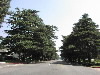
Olive Trees (76 mature) Map
Lining both sides of Lassen Street between Topanga Canyon Blvd and Farralone Avenue, Chatsworth. Native to the Eastern Mediterranean region, olive trees were introduced to California by Franciscan Missionaries. These particular trees approximate the age of Chatsworth itself, having been planted in the latter part of the 19th century. Declared: 5/10/67
Lassen Street
Chatsworth, CA
See user reviews
|
|
|
|
Top of Page
|
Valley Landmarks in Encino, California
|
|
|
Top of Page
|
Valley Landmarks in Glendale, California
|
|
|
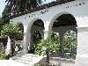
Casa Adobe de San Rafael Map URL
Built for Tomas Sanchez, first sheriff of Los Angeles County. Restored in 1932 and is now a museum owned and operated by the City of Glendale. Tours first Sunday of each month 1 p.m. to 3 p.m., Summer every Sunday 1 - 3 p.m. It's free.
1330 Dorothy Drive
Glendale, CA 91202
818 956-2000
See user reviews
|
|
|
|
|
|
|
|
|
|
|
|
|
|
Top of Page
|
Valley Landmarks in Granada Hills, California
|
101 Deodar Cedar Trees Map
White Oak Avenue between San Fernando Mission and San Jose Street. Cedrus deodara-planted in 1932. They are native to the Himalayas and valued for their size, beauty and timber. Declared: 8/3/66
White Oak Avenue
Granada Hills, CA
See user reviews
|
|
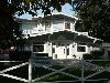
Taft House and Landscaping Map
Erected before the turn of the century. The Shingle Style residence incorporates the distinguishing characteristics of wood siding and trim, shingled gambrel roof, double hung windows, dormers, and a wraparound porch supported by turned wood columns. The matriarch of the influential Taft family occupied the home for many years. Declared: 4/16/96
16745 San Fernando Mission Blvd
Granada Hills, CA 91344
See user reviews
|
|
Top of Page
|
Valley Landmarks in Mission Hills, California
|
|
|
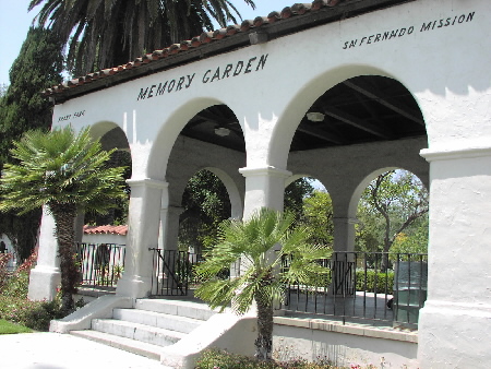
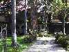
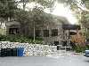
Brand Park / Memory Garden Map
Given to the city for a park November 4, 1920, it is a part of the original land grant of Mission San Fernando de Rey de Espa�a, and the colorful and picturesque atmosphere of the early California missions is preserved in Memory Garden.
15174 San Fernando Mission Blvd
Mission Hills, CA 91345
See user reviews
|
|
|
|
|
|
Top of Page
|
Valley Landmarks in North Hollywood, California
|
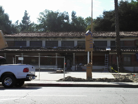
Amelia Earhart / North Hollywood Branch Library Map
Built in 1929, the original building was designed by Lewis Eugene Weston and Lewis Eugene Weston, Jr. in the Spanish Colonial Revival style. It is a one-story red brick building. The building's clerestory contains seven multi-pane recessed windows and has a small hip roof of red Spanish tiles with two chimneys. A second tile roof, below the clerestory windows, extends over offices and a porch. An open-beamed ceiling enhances the Spanish character of the library. Declared: 6/27/86
5211 N Tujunga Ave
North Hollywood, CA 91601
See user reviews
|
|
Campo de Cahuenga Map URL
The birthplace of California. This small park commemorates the signing of the Treaty of Cahuenga which was negotiated in 1847; the treaty signalled the end of hostilities in California in the Mexican-American War. Open by appointment. The adobe is a 1950 replica of the Cahuenga Adobe built on the site in 1845.
3912 Lankershim Blvd
North Hollywood, CA 91604
818 762-3998
See user reviews
|
|
|
|
|
|
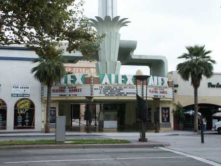
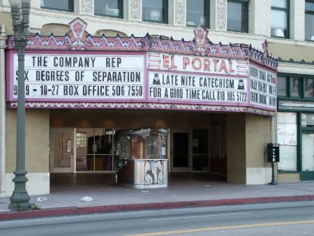
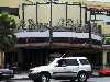
El Portal Theatre Map URL
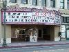
Completed in 1926, this two-story Spanish Renaissance Revival retail/office/theater building was designed by theater architect L. A. Smith. Declared: 2/9/93
5265 Lankershim Blvd.
North Hollywood, CA 91601
818 508-4200
See user reviews
|
|
Top of Page
|
Valley Landmarks in Northridge, California
|
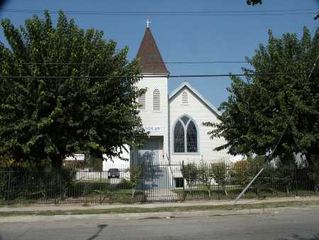
Faith Bible Church Map
Originally known as the Norwegian Lutheran Church, it was built in 1917 in the Gothic style. The church was built in the community called Zelzah, which later became Northridge. Declared: 4/7/76
18531 Gresham Street
Northridge, CA 91324
See user reviews
|
|
Oakridge and Grounds (Rancho Cordillera del Norte) Map
Built in 1937 and designed by architect Paul R. Williams in the English Manor style for actress, Barbara Stanwyck. Jack Oakie and his wife purchased the home from Miss Stanwyck a short time later. The house has had very few alterations. Declared: 3/23/90
18650 Devonshire St
Northridge, CA 91324
See user reviews
|
|
Top of Page
|
Valley Landmarks in Reseda, California
|
Adams Residence Map URL
Designed by architect Lloyd Wright and owner-built in 1939, this tiny (26' x 26') Modern home was well planned to suit the extremes of climate in the San Fernando Valley. Diagonal placement of the structure to the east- west line, combined with a swooping bat-wing roof and deep over-hangs, controls heat and light. The open floor plan flows around a central fireplace. The house has been continuously occupied by the Adams family. Declared: 10/4/96
7400 Tampa Avenue
Reseda, CA 91335
See user reviews
|
|
Top of Page
|
Valley Landmarks in San Fernando, California
|
Casa de Lopez Map
Erected by Valentine Lopez 1882. Occupied by Geronimo Lopez 1884. It's the oldest remaining building in San Fernando. Open 4th Sunday 1 p.m. to 4 p.m.
1100 Pico St.
San Fernando, CA 91340
See user reviews
|
|
|
|
Top of Page
|
Valley Landmarks in Sherman Oaks, California
|
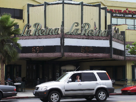
La Reina Theatre Map
The La Reina Theatre opened in 1938 and designed by eminent Los Angeles architect S. Charles Lee. The 875-seat theater was a one-story Streamline Moderne building and was the most stylistically sophisticated theater ever built in the San Fernando Valley. In 1987, its interior was gutted for shops and its facade and marquee were preserved and incorporated into the La Reina Fashion Plaza. Declared: 2/15/85
14626 Ventura Blvd
Sherman Oaks, CA 91403
See user reviews
|
|
The Magnolia Map
Built in the late 1920's, this Spanish Colonial Revival style residence includes a detached garage and chauffeur's quarters. Declared: 6/18/85
13242 Magnolia Blvd
Sherman Oaks, CA 91423
See user reviews
|
|
Top of Page
|
Valley Landmarks in Studio City, California
|
|
|
Laurelwood Apartments Map
Built in 1948 and designed by noted architect R. M. Schindler, they were cited as "an outstanding work by a major architect." Declared: 4/22/80
11833 Laurelwood Drive
Studio City, CA 91604
See user reviews
|
|
St. Saviour's Chapel Map
At Harvard School. Designed by Reginald Johnson and patterned after the Chapel at Rugby School in England with the pews facing the center aisle, it was dedicated in 1914. Declared: 2/5/65
3700 Coldwater Canyon Ave
Studio City, CA 91604
See user reviews
|
|
Top of Page
|
Valley Landmarks in Sun Valley, California
|
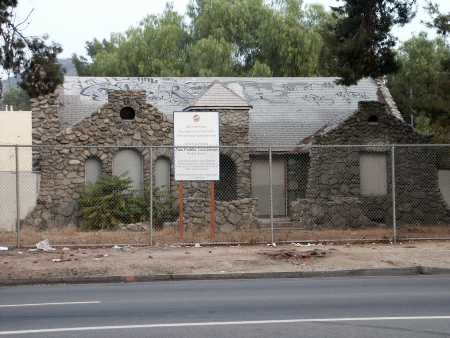
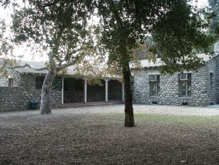
Stone House Map
Built in 1925, this Craftsman style house features rock walls, gabled roofs, arched window openings, square tower, and a stone chimney. Declared: 12/19/87
8642 Sunland Blvd
Sun Valley, CA 91352
See user reviews
|
|
|
|
Top of Page
|
Valley Landmarks in Sylmar, California
|
|
|
|
|
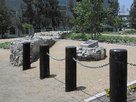
Mission Wells and the Settling Basin Map
The presence of cienegas, or swamp lands, from which water bubbled up, was one of the vital factors in the decision of the Franciscan Padres in 1797 to erect the Mission San Fernando Rey de Espana at a site two to three miles west of these cienegas. Havana & Bleeker Streets. Declared: 5/10/67
Havana St and Bleeker St
Sylmar, CA
See user reviews
|
|
San Fernando (Pioneer Memorial) Cemetery Map URL
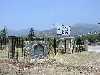
A flat, 3.8 acre Sylmar site covered with native grasses and includes a walkway and memorial patio. This is the second oldest cemetery in the San Fernando Valley and holds the remains of early pioneers, Civil War Veterans, and Mission Indians. Declared: 11/30/93
14451 Bledsoe Street
Sylmar, CA 91342
See user reviews
|
|
Top of Page
|
Valley Landmarks in Tujunga, California
|
|
|
McGroarty Home and Grounds Map URL
John Steven McGroarty was Poet Laureate of the State of California from 1933 until his death in 1944. Built in 1923, this fieldstone and stucco home designed by Arthur B. Benton is now used for art classes, historical and author's groups, musicales and recreational activities. Declared: 2/4/70
7570 McGroarty Terrace
Tujunga, CA 91042
818 352-5285
See user reviews
|
|
Top of Page
|
Valley Landmarks in Van Nuys, California
|
Baird House Map
Built in 1921 for the family of Robert J. Baird, owner of the Van Nuys Nursery Company, this Bungalow-style residence is now the property of the Volunteer League of the San Fernando Valley, Van Nuys. Declared: 10/18/78
14603 Hamlin Street
Van Nuys, CA 91411
See user reviews
|
|
Pacific Electric Picover Railway Station (site of) Map
The building consisted of a larger portion, built in 1932, which served as a vegetable packing shed, and a smaller portion built in 1917 as a passenger shelter for Pacific Electric patrons on the Canoga Park line. It moved onto this site after the line was abandoned in 1938. (Destroyed by fire in 6/4/1990) Declared: 1/11/89
16710 Sherman Way
Van Nuys, CA 91406
See user reviews
|
|
Tower of Wooden Pallets Map
Constructed by Daniel Van Meter in 1951 of approximately 2,000 wooden pallets which are 3'x3'x6" in size. The Tower of Pallets, in a 22-foot circle at the base, covers the reported grave of a child buried in 1869. Obscured by dense vegetation. Declared: 4/19/78
15357 Magnolia Blvd
Van Nuys, CA 91403
See user reviews
|
|
|
|
|
|
Van Nuys Woman's Club Building Map
Constructed in 1917 as a Craftsman-style building. The club, founded in 1912, is one of the oldest social institutions in the San Fernando Valley. Declared: 10/18/78
14836 Sylvan Street
Van Nuys, CA 91411
See user reviews
|
|
Top of Page
|
Valley Landmarks in West Hills, California
|
Chatsworth Reservoir Kiln Site Map
Aka "The Chatsworth Calera" and located Southeasterly from the intersection of Woolsey Canyon Rd and Valley Circle Blvd . It was used to make bricks and tiles for the San Fernando Mission. Although the name suggests it is located in Chatsworth, the current city bounds of West Hills clearly shows it is located in West Hills. It was declaireded a landmark on 4/2/1975.
Valley Circle Blvd and Woolsey Canyon Rd
West Hills, CA
See user reviews
|
|
Orcutt Ranch (Rancho Sombra del Roble) Map URL
This 1920 adobe residence was the home of W. W. Orcutt, one of the founders of the oil production industry in California. In 1901, Orcutt discovered the La Brea Tar Pits' prehistoric fossils. Declared: 1/22/65. Open daily Sunrise to Sunset.
23600 Roscoe Blvd
West Hills, CA 91304
818 346-7449
See user reviews
|
|
Top of Page
|
Valley Landmarks in Woodland Hills, California
|
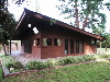
Old Trappers Lodge Map
A "Twentieth Century Folk Art Enviroment". Originally at 10340 Keswick Ave., Sun Valley; relocated to Los Angeles Pierce College
6201 Winnetka Ave
Woodland Hills, CA 91371
See user reviews
|
|
Pepper Trees Map
Canoga Avenue from Ventura Blvd south to Saltillo Street. The approximately 300 pepper trees now growing in the city-owned parkway started from a seed (Schinus molle, native to South America) at the nursery owned by Victor Girard of the Blvd Land Company, owners of most of what is now Woodland Hills. The trees were planted in the 1920's and now form an arch over the street. Declared: 1/5/72
Canoga Avenue
Woodland Hills, CA
See user reviews
|
|
Top of Page
|

 And More....